Master illustrator Mario Camerini creates hand-painted maps of Rome.
Andy Devane
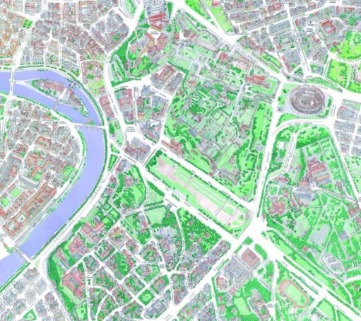
Rome's central districts, or rioni, have been immortalised in a series of 22 hand-painted maps by master illustrator Mario Camerini.
The birds-eye view maps – the latest in a long series by the artist – show areas such as Rione Parione (Campo de' Fiori-Piazza Navona), Trastevere, Rione Colonna (either side of central stretch of Via del Corso), Borgo, and S. Saba.
Wanted in Rome put some questions to Camerini who has been making maps since the 1990s, sometimes for the Botteghiamo association which promotes traditional artisan activity and historic workshops.
What was the first map you created and where did you come up with the idea?
The first map was the old city of Rhodes [Greece], in 1993. I lived in the old city, which is beautiful, but there were no maps, only those specialist ones for archaeologists, so I made one myself.
Where are you from, and what is your background as an artist-illustrator?
I was born in Brazil (I am Jewish and my family fled to Brazil in 1938 due to the Italian racial laws). My father was a painter, my mother the daughter of a sculptor, so it was in my DNA.
What is your artistic process behind each map?
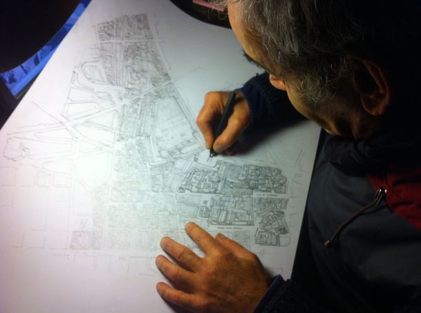
I start from a two-tone technical map, then district by district I paint the houses, based on Google Maps or Bing Maps, but slightly distorting the aspect ratio to gain the necessary space to show the streets and house elevations. I then add ink to the drawing and finally colour it with watercolours.
Where can people buy your maps of Rome?
The Rome maps can be purchased in digital print, on paper or canvas painting through my website.


